
AMARANTE
GPS: N 41º 16' 10''; W 8º 04' 42''
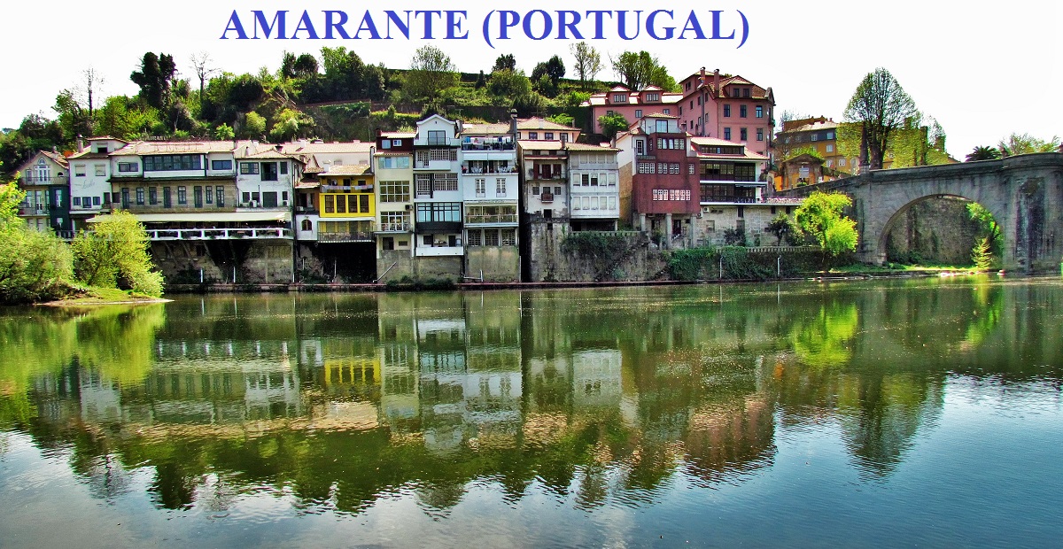
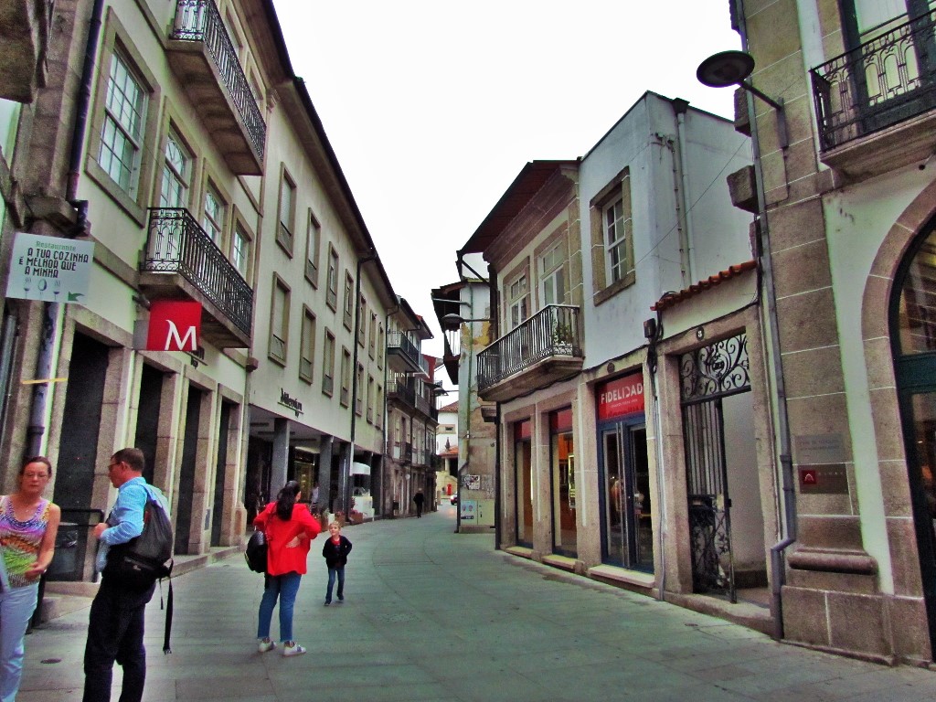
Amarante is situated in the agricultural lands of the Minho region and belongs to the Porto district, region Norte and sub-region Támega. The Tâmega River runs through the town and is crossed by a large arched bridge, the Ponte São Gonçalo. Nowadays the older centre of town is dominated by a multitude of cafés and restaurants dotted along the steep banks of the southern side of the Tâmega River.
On the abandoned Tâmega railway line between Amarante and Chapa Stations, the Council of Amarante built the ˝Ecopista˝ pathway for bicycles and pedestrians. The Tâmega Line Ecotrack is 9.3 km (5.8 mi) long and 3.5 m (11.5 ft) wide, running very close to the Támega River.
The Amarante Golf Course, designed by Portuguese architect Jorge Santana da Silva, lies in Quinta da Deveza and was founded in 1997. It is an 18-hole, par 68 course with a total length of 5.030 metres. It is located in the Fregim parish, around 6 km (4 mi) from the town of Amarante.
Amarante lies around half a kilometre from the A4 Motorway. There is also a bus station, served principally by Rodonorte, to the south of the Támega river.
The architecture of the Amarante region is mainly in the Romanesque style, with a number of Romanesque monuments (colonnades, arches, tympana and columns) throughout the region. They were built in deserted areas or on crossroads on the outskirts of inhabited areas, serving as meeting places, accommodation and defensive positions. Amarante became part of the Sousa Valley Romanesque Route (Rota do Românico) project on the 12 March 2010.
Important religious buildings can be found to the north of the Tâmega, and include the Travanca monastery, the Mancelos church, the Telões church, the Freixo de Baixo monastery and the Gatão church. On the southern side of the river, can be found the Jazente church, the Lufrei church and the Gondar monastery which are in a more modest style.
In the second French invasion, during the Peninsular War, French forces commanded by Marshall Soult found themselves at the bridge over the Tâmega and needed to secure their connection to Spain, while advancing from Porto to Marco de Canaveses through Amarante. Soult, realizing that Beresford's Portuguese and English forces were advancing on him, sent a column to the Tâmega valley, in order to prepare the way for a new column. Under the column, commanded by Loison, through looting, skirmishes and unsuccessful attempts to cross the river, entered in Amarante on 18 April 1809, having looted and burned down the villages of Vila Meã, Manhufe and Pidre. In the village, they continue to loot and burn down buildings, except for larger family residences, which were left intact and destined to function as the French headquarters and field hospitals.[5] There are still vestiges of these events, including those in the Estate of Magalhães, the facade of the Church of São Gonçalo, the perforated tiles in the sacristy and the damaged pyramids on the bridge.
The bridge was also significant to the resistance in the northern campaign. Loison did not count on the entrenched conflict between his forces and the Anglo-Portuguese forces, commanded by Brigadier Silveira. These forces, which included badly-equipped, inexperienced citizens and clergy, were able to resist for the next 14 days, impeding the passage of Napoleonic forces, later known as the heroic defense of the bridge of Amarante. The encirclement of the bridge ended on 2 May, around 3:00, following a diversionary manoeuvre by French forces that diverted a small pocket of Portuguese stationed at Eira do Paço, who believed the French would attempt to across by Morleiros. Taking advantage of the fog, the French placed gunpowder near the Portuguese trenches along the bridge, then detonated the explosives. These created confusion and panic among the defenders and caused death and injury in their ranks. Loison then continued his journey, until he was forced to withdraw in the upper Douro by Brigadier Silveira's forces, who he had reorganized, during Napoleon's northern march to the city of Lisbon. For his efforts, Silveira was given a cavalry command, owing to his defence of the bridge, and attributed the title of Count of Amarante and elevated to the status of General. The town was also awarded the Order of the Tower and Sword, which it displays on its coat-of-arms.


💓💓💓💓💓
SEARCH IN ALPHABETICAL ORDER
IN THE DISTRICT OF PORTO

Cête;
Maia;
PORTO - WHERE THE RIVER KISSES THE SEA;PORTO - Sao Bento Train Staion + Public
Transport in Oporto Metropolitan Area;
PORTO - PORTO ESSENTIALS I;
PORTO - PORTO ESSENTIALS II;
PORTO - PORTO ESSENTIALS III;
PORTO - PORTO ESSENTIALS IV;
Póvoa do Varzim;
💓💓💓💓💓
Return to mainland Portugal &
the Azores and Madeira islands

