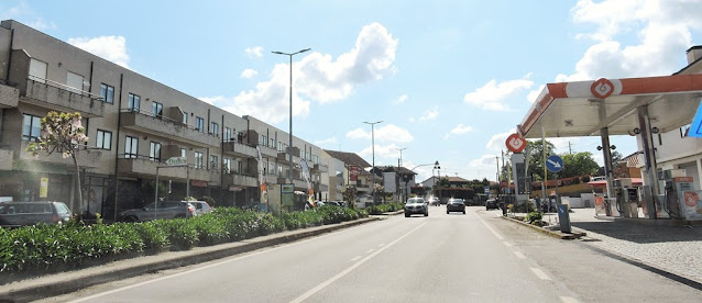
AGRELA
41° 15' 27" N; 8° 28' 25" W
Agrela is a Portuguese parish in the municipality of Santo Tirso with an area of 7.05 km², 1 584 inhabitants (2011) and a population density of 224.7 inhabitants/km².
It is surrounded to the north by the parishes of Reguenga and Lamelas, to the south by the parish of Sobrado (Valongo), to the west by the parish of Água Longa and to the east by the parish of Seroa (Paços de Ferreira).
It is home to one of the best-known producers of the region's characteristic Vinho Verde wines.
In the parish church you can see the altar of Nossa Senhora da Guia, from the old chapel. In this parish there are also some of the most beautiful farms in the county.
Geographic location
Agrela is located in the extreme south of the municipality, alongside Água Longa.
It also enjoys an excellent geographical location, which allows any inhabitant to reach Santo Tirso, Paços de Ferreira, Porto, Alfena and Valongo by car within 15 minutes. The EN207 begins there, which connects Agrela to the cities of Paços de Ferreira and Vila de Lousada. It is located near one of the entrances to the A41 motorway, as well as the EN105, which connects Porto to Alfena and Guimarães.
💓💓💓💓💓
Cête;
Maia;
PORTO - WHERE THE RIVER KISSES THE SEA;PORTO - Sao Bento Train Staion + Public
Transport in Oporto Metropolitan Area;
PORTO - PORTO ESSENTIALS I;
PORTO - PORTO ESSENTIALS II;
PORTO - PORTO ESSENTIALS III;
PORTO - PORTO ESSENTIALS IV;
Póvoa do Varzim;
💓💓💓💓💓
Return to mainland Portugal &
the Azores and Madeira islands


